
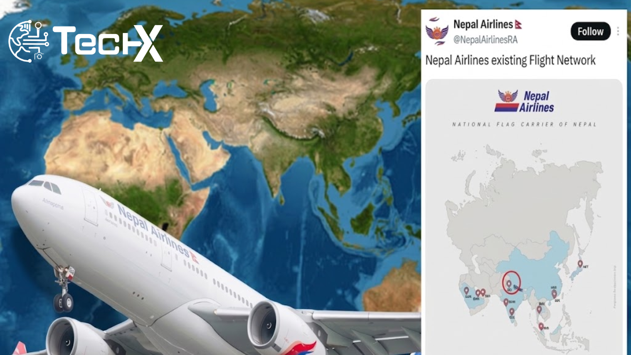
Nepal national carrier, Nepal Airlines, came under heavy online criticism after sharing a flight network map that appeared to incorrectly depict the disputed region of Kashmir as part of Pakistan. The map circulated on social media and quickly triggered widespread debate and backlash from users in different countries.
Social Media Reaction
The map sparked strong reactions online, particularly from users who pointed out the sensitive nature of territorial representations in South Asia. Many criticized the airline for what they believed was an inaccurate depiction of internationally disputed boundaries, leading to heated discussions across platforms.
Clarification from the Airline
Following the backlash, Nepal Airlines issued a clarification and apology, stating that the map was an error and not intended to reflect any political position. The airline emphasized that the mistake was unintentional and related to graphical representation issues rather than policy or official stance.
Sensitivity of Kashmir Dispute
The incident highlights the ongoing sensitivity surrounding the Kashmir region, which remains a disputed territory between India and Pakistan. Even minor inaccuracies in maps or representations can lead to diplomatic and public reactions, especially in the digital age where content spreads rapidly.
Importance of Accurate Representation
Aviation and international organizations are generally expected to follow strict standards when displaying geographical information. Errors in mapping can lead to misunderstandings and diplomatic concerns, making accuracy extremely important for airlines and global carriers.
Conclusion
In conclusion, the controversy involving Nepal Airlines was primarily a result of an unintentional mapping error that led to public backlash. While the airline has clarified and apologized, the incident underscores the importance of careful and accurate representation of sensitive geopolitical regions in official communications.