
The Venezuela twin earthquakes that struck on June 24, 2026, caused one of the worst natural disasters the country has seen in over a century. Two large earthquakes hit northwestern and central Venezuela on that day, with both epicenters located in the Veroes municipality in the state of Yaracuy. The first quake measured magnitude 7.2, and it was followed just 39 seconds later by a magnitude 7.5 mainshock. The ground did not stop shaking for nearly a full minute, and by the time it did, entire neighbourhoods lay in ruins.
Venezuela Twin Earthquakes: What Happened on June 24
Venezuela was struck by two major earthquakes less than a minute apart on June 24, 2026. The U.S. Geological Survey (USGS) recorded a magnitude 7.2 event at 22:04 UTC, followed by a magnitude 7.5 event near Yumare in northern Venezuela. Since June 24 is a national holiday in Venezuela, marking the 1821 Battle of Carabobo, many people were at home instead of at work when the earthquake struck, which likely added to the casualty count.
Immediately after the earthquake, Venezuelan Acting President Delcy Rodriguez said that the La Guaira area was designated a disaster zone. State interior minister Diosdado Cabello said that ‘several’ Venezuelan states were impacted.
Death Toll and Injuries
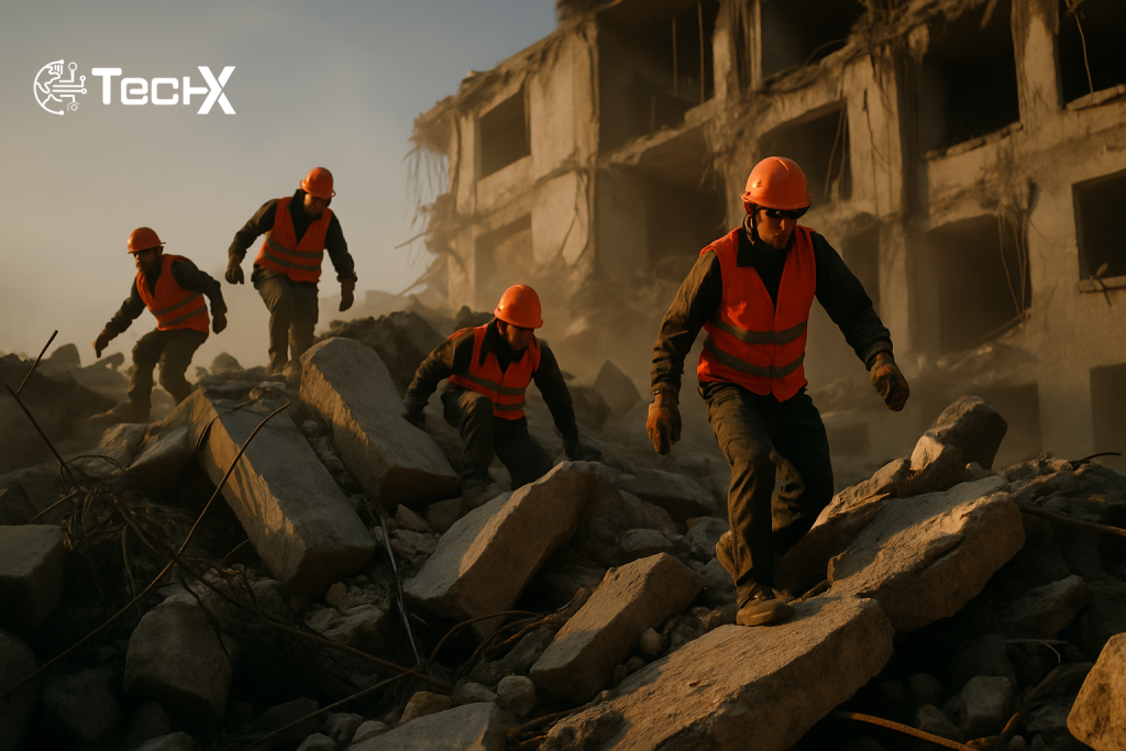
At least 235 people were killed, more than 4,300 were injured, and over 40,000 were reported missing. Casualty reports remained scarce, particularly in more remote areas, believed to be due to disrupted communications or a possible media blackout in Venezuela.
Acting President Rodriguez warned that the death count is likely to rise, as operations focused on searching through rubble had not been completed. She specifically mentioned La Guaira, which was described as a ‘disaster zone’, because the number of deaths from that state had not been verified or added to the total.
The USGS, using predictive modelling to estimate the death toll, said it would most likely run into the thousands and has a substantial probability of exceeding 10,000. Officials have urged the public to brace for the numbers to climb further.
Scale of Destruction Across Venezuela
Dozens of buildings reportedly collapsed across Caracas, including a bank. Venezuelan Interior Minister Diosdado Cabello said that the Los Palos Grandes and Altamira municipalities were the worst-affected parts of the city.
In an unspecified area in southeastern Caracas, almost all high-rise buildings were heavily damaged or destroyed, with many of them collapsing. Simon Bolivar International Airport was damaged, and all flights departing from or arriving there were cancelled. Buildings also collapsed in Trujillo, Carabobo, Aragua, Miranda and La Guaira.
About 80 percent of Venezuela’s population lives in quake-prone areas, and many live in houses not built to withstand strong earthquakes. In hard-hit areas like Altamira in Caracas, many of the collapsed buildings were built on sediments, making them more vulnerable to seismic waves. Informal housing across several areas further compounded the problem, as those structures were not prepared to sustain very strong earthquakes.
Why the Damage Was So Severe
Seismologists say the location of the fault is key to understanding the destruction. In northern Venezuela, the Caribbean plate and South American plate interact along a complex plate boundary called the Boconó-Morón-El Pilar Fault System. It is a series of right-lateral strike-slip faults that form part of the transform plate boundary in the southern Caribbean. This fault runs 1,300 km along northern Venezuela, from the central Venezuelan Andes through its northeastern coast and towards Trinidad.
A geophysicist at the University of California, San Diego, told Al Jazeera that the damage was so extensive because Venezuela lies in a ‘massive strike-slip fault zone’ straddling the Caribbean and South American tectonic plates. Caracas is also in a deep sedimentary basin, which further amplifies seismic waves.
This mainshock is the largest in Venezuela since 1900, when a magnitude 7.7 earthquake struck northeast of Caracas. That context helps explain the shock felt across the region.
Tsunami Warning Issued, Then Cancelled
A tsunami alert was issued shortly after the earthquakes, but U.S. Tsunami Warning Centers information later showed the event was listed as a cancellation, with no ongoing tsunami warning, advisory, watch, or threat in effect. Following the seismic events, tsunami warning systems had initially issued alerts across multiple Caribbean regions, including Venezuela’s northern coastline and nearby island territories such as Aruba, Bonaire, and Curaçao. Advisory-level warnings were also extended toward Puerto Rico and the U.S. Virgin Islands.
The quakes were also felt in Colombia’s Caribbean and northeast regions, but there were no reports of damage or injuries. The Colombian Maritime Authority confirmed that the country’s Caribbean coast was not at risk of a tsunami.
International Response
Countries around the world moved quickly to send help. Several countries with earthquake-response experience, including Mexico, Chile and El Salvador, are sending emergency teams and medical supplies. The United States also announced support, including rescue crews from Virginia and California and aerial imagery to assess damage in remote coastal areas.
The United States Southern Command said it is ‘surging available assigned’ US forces in the region to support earthquake relief operations in Venezuela. SouthCom directed significant forces to the effort, including the amphibious transport ship USS Fort Lauderdale and the littoral combat ship USS Billings.
The United Nations’ children’s agency UNICEF warned that thousands of children are at risk in Venezuela after the two earthquakes struck. About 3.9 million children live in areas affected by the quakes, and many families need urgent assistance, UNICEF said.
A Country Already Under Strain
The disaster has hit a nation that was already struggling badly. Venezuela’s public services are buckling under strain, hospitals are short of equipment and medication, and frequent power outages have left emergency response stretched thin. The earthquakes have exposed the fragility of a system already pushed to its limits.
The USGS PAGER service estimated a 39% probability of economic losses between US$10 billion and US$100 billion, and a 30% probability of economic losses exceeding US$100 billion, with upper estimates amounting to up to 20% of Venezuela’s GDP.
Venezuela has one of the most restricted media landscapes in the world, which has made it difficult for residents or concerned loved ones abroad to gain information about damage or casualties. More than 200 websites in the country are blocked, including local and international news, social media sites and censorship circumvention tools.
For up-to-date humanitarian data and relief coordination on the disaster, see the official response page from the Pan American Health Organization (PAHO/WHO) and real-time seismic data from the United States Geological Survey (USGS).
Frequently Asked Questions
How strong were the Venezuela twin earthquakes on June 24, 2026?
The first earthquake measured magnitude 7.2 and was classified as a foreshock, followed 39 seconds later by a magnitude 7.5 mainshock. Both struck in the state of Yaracuy, western Venezuela.
How many people died in the Venezuela earthquakes?
At least 235 people died and more than 4,300 were injured. Venezuela’s health minister, Carlos Alvarado, clarified that the number reflected casualties recorded at hospitals, meaning the true toll could be higher once remote areas are reached.
Was there a tsunami after the Venezuela earthquakes?
A tsunami warning was issued but was swiftly cancelled after the danger passed. Coastal areas near Puerto Rico and the U.S. Virgin Islands were initially placed under advisory, but no significant waves were recorded.
Which areas of Caracas suffered the most damage?
Venezuelan Interior Minister Diosdado Cabello said the Los Palos Grandes and Altamira municipalities were the worst-affected parts of the city. In an unspecified area in southeastern Caracas, almost all high-rise buildings were heavily damaged or destroyed. The coastal state of La Guaira was also declared a full disaster zone.